Last month, the tristate was dealing with a nearly insufferable heatwave. Unfortunately for its residents, Mother Nature isn’t taking it easy on them this week either.
Sunday started hot and humid and ended dark and stormy. According to NBC New York, the combination of high temperature and humidity only fueled the storm, giving it more power and making it more dangerous for tristate residents.
A “strong” and at times “severe” storm, yesterday’s weather forecast included the potential for damaging winds, hail, tornado development, and flash floods. The entire tristate was issued a “severe thunderstorm watch” through 7 p.m.
Flash flood warnings were in effect in New Haven, Fairfield, Putnam, and Westchester until 5:45. According to NBC News statistics, some areas saw 1 to 2 inches per hour of rainfall. Meanwhile, Sullivan and Ulster counties reported fallen trees and wires earlier than 1 p.m. At 2:35 p.m., Brewster police responded to a 911 call reporting people trapped in a car stuck in water.
New York City’s emergency management office, according to NBC New York, warned that the biggest threat “is debris from damaging winds…seek shelter should a storm take place”. Thankfully, a cold front late Sunday evening drove the storm away. So, we get a break.
For now.
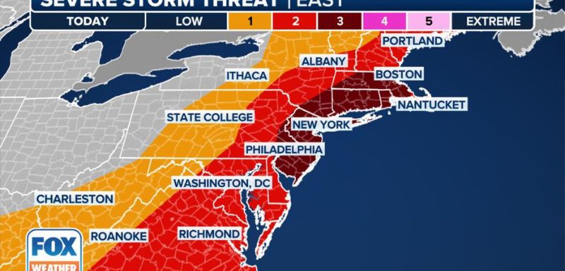
Today isn’t scheduled to be awful, with increased cloud cover and temperatures hardly hitting 80 degrees. Unfortunately, Tuesday is going to pack a powerful punch. According to WGEM, temperatures will again reach the 90s. Meanwhile, dew points will rise from the low 60s to 70s. For that night, the Storm Prediction Center has supplied a Level 1 risk for severe weather for most of the tristate. A Level 2 risk for strong to severe storms has also been issued in the northern and western tristate areas.
While the storm is expected to last from late Tuesday to early Wednesday, exact times are still subject to change. Though temperatures will return to what can be considered normal, mid to upper 80s, for early July, the chance of rain will continue to linger throughout the week.
Don’t let this put a damper on your July 4th plans though. The weather is always subject to change and it’s not scheduled to rain all day. Watch your location’s weather forecast and plan Independence Day festivities accordingly.